-
Quiet Cabin
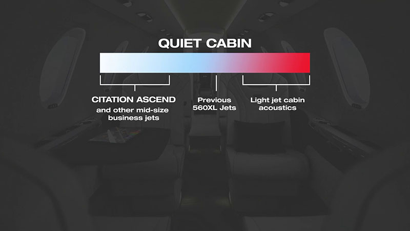
Experience redefined aircraft comfort with our quiet cabin technology. By using enhanced sound dampening, you can enjoy a quieter ambiance usually reserved for larger jets. With sound levels quieter than previous 560XL jets and light jet aircraft, passengers can engage in a conversation, work or relax distraction-free environment.
-
Speakerless Sound
Indulge in an enhanced auditory journey during flight with the
optional Bongiovi sound system. Become immersed in a surround
sound experience that allows you to fully enjoy your favorite
music, shows or optional XM radio through the cabin management
system.
-
Interior Customization
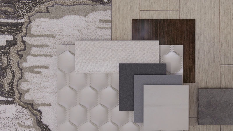
Interior customizations on the Citation Ascend™ jet
match the individuality of your aspirations for your time in
the air. This aircraft sets the standard for in-flight comfort
and durability. Our experts help you personalize your aircraft
with luxurious and sustainable materials, reflecting your
vision and values.
-
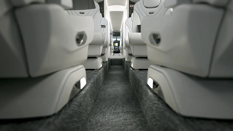
Flat Floor
Cabin comfort is now transformed by the ability to choose either a flat floor or a dropped aisle. With a flat floor, enjoy increased levels of generous legroom with abundant space to fully swivel your seat and stretch your legs in flight. Enhance your cabin's elegance by selecting optional stone or luxury vinyl flooring for the galley and lavatory areas.
-
Dropped Aisle
Select a floor style that aligns with your needs. Customize
your Citation Ascend™ jet by selecting either a sleek
flat floor or an elegant dropped aisle configuration, so that
your aircraft reflects your one-of-a-kind tastes.
-
Refreshment Center
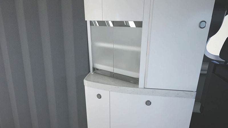
The refreshment center's larger, extendable work surface
provides ample space to craft food and drinks. Select from a
diverse array of high-end surface materials, including an
optional stone finish. Enjoy hot beverages with the standard
hot tank or power a self-serve beverage machine with the
optional high-powered outlet.
-
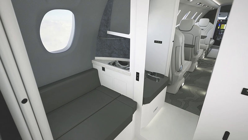
Side-Facing Couch
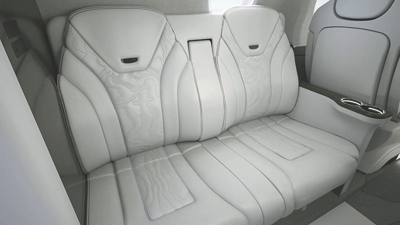
The side-facing couch is more than just two comfortable seats,
it can be transformed to provide additional in-flight
accessible storage. With folding seatbacks that reveal a
rubberized surface, this space keeps items in place during
taxi, takeoff and landing to meet your needs for each flight.
-
Cabin Windows
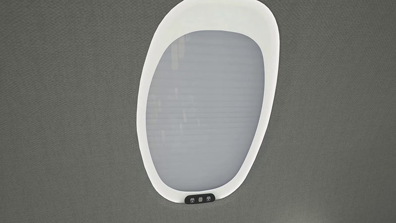
All-new cabin windows are nearly 15 percent larger and include
transparent and opaque shade settings via wireless controls.
The optional lighted window rings illuminate your cabin with
extra brightness, amplifying cabin allure and enhancing the
overall ambiance.
-
Lavatory
Customize your lavatory flooring with the option to choose
carpet, stone or luxury vinyl. For a refined and stylish
enhancement, select the optional stone vanity counter and
elevate your space to new heights of sophistication.
-
Aft Cabin
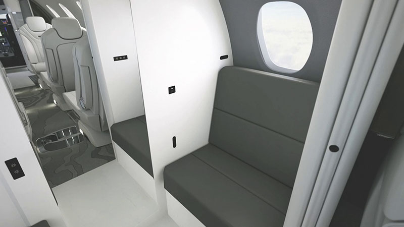
Unlock cabin versatility and an organized travel experience
for you and your passengers with secure stowing and hanging
storage provisions. This flexible space caters to your unique
needs, and can be used for a passenger seat, coat storage or
extra in-flight accessible baggage storage.
-
Seat Controls
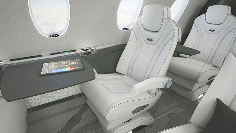
Experience heightened convenience and comfort in the Citation
Ascend™ jet. The seats, which feature a proven Citation
design and seamlessly stowable armrests, now have an all-new
push button release feature to control your seat position.
This allows you to effortlessly swivel and track your seat
forward and aft, providing an unmatched level of control.
-
Comfort and Ergonomics
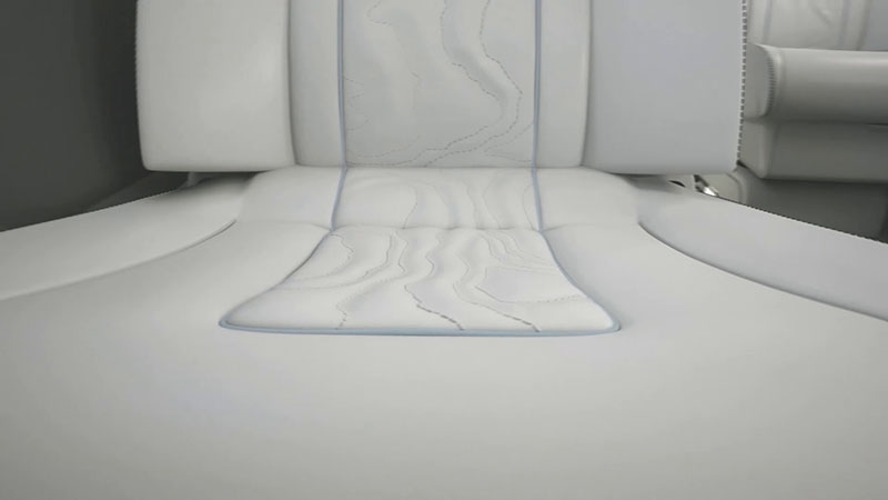
Experience ultimate relaxation with newly engineered aircraft seats that feature customizable cushion firmness and optional lumbar support. Ergonomic designs and luxurious optional quilted patterns converge to create a perfect fusion of comfort and style on the Citation Ascend™ aircraft.
-
Wireless Smartphone Charging
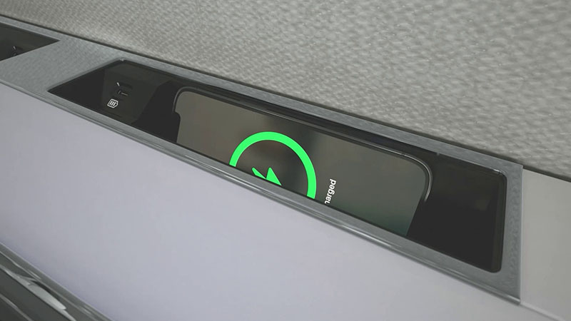
Keep your devices fully powered and ready for use with
convenient charging options for passengers and crew. This
aircraft features three universal outlets, 19 standard USB
ports and wireless smartphone charging available at every main
cabin seat, a feature exclusive to the Citation Ascend™
in the midsize jet category.
-
Cabin Management System
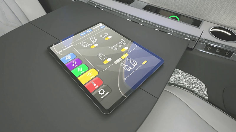
The Clairity™ Cabin Management System gives you complete
control of your in-flight experience. From adjusting cabin
temperature and lighting to operating the window shades and
entertainment system, your flight is easily managed at your
fingertips.